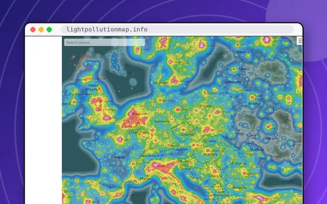
The Light Pollution Map is a world map colored by how bright the night sky is. Zoom to your location and you get a color-coded picture of how washed-out the sky is above your house, your town and the region around you. Dark places show up as dark colors; big cities glow.
Its practical use is finding places to see the stars: look for the darkest patch within driving distance and plan a trip. Its emotional use is looking at your own neighborhood and feeling a little sad about the Milky Way you cannot see.
There are layers and overlays to experiment with, and the map is zoomable down to street level. It works on phones, which is convenient if you are planning a night out. For what to look at once you get there, try /site/stellarium-web. More in /category/science-space.
Tips for getting the most out of it
- Search your town first, then look for dark patches nearby.
- Try the layer options to compare views.
- Use it on your phone when planning a stargazing trip.
Questions about Light Pollution Map
What is the Light Pollution Map?
It is an interactive world map that shows how bright the night sky is because of artificial light. It helps stargazers find darker places and shows how much light pollution affects your area. Plan on about 5 min. It works on phones.
How can I find dark skies near me?
Zoom the map to your area and look for the darkest colors within reach. Those places usually have the best view of stars. Check conditions like weather and moonlight before you travel, since the map shows light pollution only. Plan on about 5 min.
Sites like Light Pollution Map

LightningMaps.org
Watch lightning strike around the world in near real time.
- 5 minutes
- Works on phones
- Alive · checked 16 days ago

USGS Latest Earthquakes
A live map of every notable earthquake on Earth.
- 5 minutes
- Works on phones
- Alive · checked 16 days ago

Where the ISS at?
See exactly where the International Space Station is right now.
- 30 seconds
- Works on phones
- Alive · checked 16 days ago
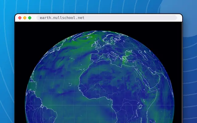
earth
A gorgeous live globe of the world's winds, weather and ocean currents.
- Rabbit hole
- Works on phones
- Alive · checked 16 days ago

Windy
Animated wind, wave and storm maps with a huge layer menu.
- Rabbit hole
- Works on phones
- Alive · checked 16 days ago

The Scale of the Universe 2
The original Flash-era zoom through everything, rebuilt for HTML5.
- 5 minutes
- Works on phones
- Alive · checked 16 days ago